


By Penny Marbel | Interview with Rob Miller, studio videographer, cinematographer and licensed drone pilot
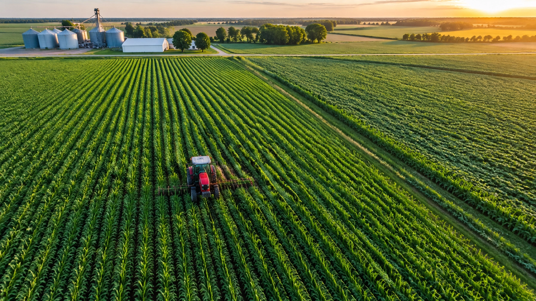
A ranch survey is more than a high-up view of a field. It can give you an organized look at crop patterns, irrigation concerns, acreage, fence lines and water sources, without walking every stretch of ground first.
I asked Rob Miller how he approaches agricultural work, what aerial imagery can and cannot tell a rancher, and how Spokane Productions plans a safe, useful survey.
WHAT A CROP SURVEY CAN SHOW
A ranch can cover a lot of ground. Aerial imagery gives the team a way to see its layout and spot areas that may need a closer look. I asked Rob what a practical deliverable looks like.
Penny Asked: If I hire you for a drone crop survey, what can I expect to receive that helps me make decisions on the ranch?
Rob: The first thing is a clear view of the property and the areas you want covered. Depending on the job, that could include field imagery, acreage and field mapping, irrigation patterns, or places where crop growth looks different. We can also look at fence lines, access routes and water sources.
There’s a difference between seeing a pattern and diagnosing its cause. A standard aerial image can show where something looks uneven. It can’t tell you by itself whether that’s a nutrient issue, water stress, pests, disease or something else. That takes the right sensor, good timing and someone on the ground to check what the image is showing.
For mapping work, the Mavic 2 Pro is a general-purpose option. It can support photogrammetry and mapping workflows. The exact deliverable depends on the area, flight plan, image quality and what the client needs. If the goal is a cinematic shot rather than a field map, that’s a different job. The Inspire 2 is built for that kind of film work, including dual-operator flights.
WHY TIMING AND REPEATABLE IMAGERY MATTER
A field can look healthy from the road while a corner or irrigation line tells a different story from above. I asked Rob how repeated flights can help a rancher catch changes and decide where to investigate.
Penny Asked: Can a drone crop survey catch problems early enough to save time or inputs? And how quickly can it cover a field?
Rob: The useful thing is being able to look across the whole field and pick out patterns. Sensors may detect changes in plant reflectance or canopy temperature before a problem is obvious to the eye. Some crop-health sources describe a possible lead time of 7–21 days for particular issues, such as nutrient deficiencies or disease. That isn’t a guarantee. Timing varies by crop, stress type, sensor, weather and how often you fly. You still need to verify an alert on the ground.
For a sense of scale, Kansas State University Extension reported that a 150-acre field that might take at least half a day to scout manually could be covered by drone in about 30 minutes. That is an example, not a promise for every property. Flight time is only part of the job. Terrain, wind, resolution, battery changes, image processing and ground checks all matter. The University of Nebraska–Lincoln’s CropWatch guidance also emphasizes combining regular flights with ground observations.
You’ll see research and industry reports describing water-use-efficiency improvements in the 10–30% range for some integrated precision-management systems. Those results depend on the crop and management plan. The drone is one tool in a larger process; it does not create those savings by itself. One specific study of an integrated UAV scouting and variable-rate treatment system reported a yield improvement of about 11.7%. That is a study result, not a yield forecast for every ranch. I’d use imagery to help identify where to check and discuss next steps with the rancher or their agronomist.


WHY HIRE A LICENSED PILOT
A capable aircraft is easy to buy. A professional flight takes training, planning and compliance. Rob and I talked about what ranchers should check before hiring someone to fly over their property.
Penny Asked: If a neighbor has a drone, why not ask them to do the survey? What should I look for in a commercial pilot?
Rob: If you’re hiring someone to fly for your business, make sure they’re qualified for commercial work. In the United States, that generally means a current FAA Part 107 remote pilot certificate. The pilot must complete recurrent training every 24 calendar months to stay current.
The aircraft must be registered when required and comply with Remote ID requirements. Before a flight, the pilot must check the airspace and obtain approval when the location requires it. Rural does not always mean clear airspace. The FAA says LAANC can provide near-real-time authorization in eligible locations, while other requests may take longer. We check the actual site and conditions rather than assume.
There are real consequences for skipping those steps. The FAA says failure to register an aircraft that must be registered can bring civil penalties up to $27,500. Other unsafe or unauthorized operations can carry separate penalties. There can also be insurance and liability concerns if an incident occurs. A client’s potential responsibility depends on the facts, but hiring an unqualified operator can create risk for everyone involved. Ask about the pilot’s certificate, aircraft registration, airspace plan and insurance before the flight.

HOW A RANCH SURVEY DAY RUNS
Rob’s work often takes him beyond easy road access. A ranch survey needs the same attention to terrain, light and logistics. I asked him how he plans the day and gets imagery to the client.
Penny Asked: What does a survey day look like from the first call to delivery, especially if the fields are remote or difficult to reach?
Rob: We use four steps: scouting, safety and compliance, capturing, and delivery.
First, we talk through the property, the areas you want covered and what you need to do with the imagery. We scout when possible. Some locations are a short drive from the road; others need off-road access or an ATV. I’ve camped overnight to be in the right spot for sunrise. On a rural shoot, the plan has to fit the land and the light.
Then we check the airspace, hazards, weather and flight requirements. We confirm the aircraft and sensor suit the job. For general mapping and survey work, the Mavic 2 Pro is a practical choice. For a film-style shot, like an ATV crossing the prairie and a cowboy-hat orbit at sunset, the Inspire 2 gives us a cinematic setup and can support dual-operator work. One person can concentrate on flying while the other frames the shot.
We capture the agreed areas, review the files and deliver the imagery in the format we discussed. Depending on the project, that could mean stills, video or mapping files such as an orthomosaic. We also keep three backup copies of project media while work is underway. A survey should arrive organized and ready for the client to use, not as a confusing pile of files.

PLAN YOUR CROP SURVEY
Agricultural drone use is growing. The American Farm Bureau Federation reported that U.S. drone-treated acreage rose from 3.7 million acres in 2023 to 16.4 million in 2025. Those figures describe acreage treated by agricultural drones, not crop-survey acreage, but they show how quickly drone operations are expanding in agriculture.
What parts of your property would you like to see more clearly? Contact Spokane Productions to discuss a crop survey or other aerial production needs. Read our first interview with Rob Miller, or visit our video production page to learn about our aerial and production services.
BOOK A CROP SURVEY WITH SPOKANE PRODUCTIONS
Contact our team to talk through your property, survey goals and schedule. Spokane Productions is located at 5380 E Seltice Way, Suite A, Post Falls, Idaho. We look forward to working with you!


SEO title: Drone Crop Survey for Ranchers | Spokane Productions
Slug: drone-crop-survey
Meta description: See how a drone crop survey can help ranchers map fields, spot areas to check and review acreage, irrigation, fences and water sources.
Focus keyphrase: drone crop survey
Categories: Video Production, Cinematography, Locations