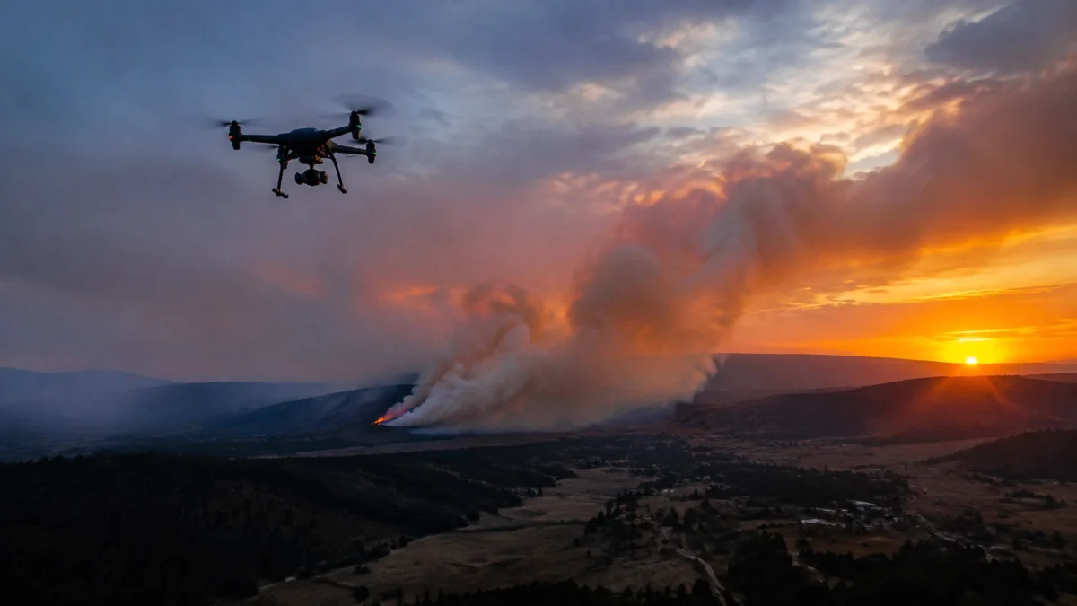
A drone can give emergency teams an early view of a scene. It can help locate a person on a remote trail, survey flooding, or document property damage after a storm. But emergency response is not a place for guesswork. Safety, agency coordination and airspace rules come first.
I spoke with Rob Miller, Spokane Productions studio videographer, cinematographer and licensed drone pilot, about where aerial support can help, and when a professional pilot must stay grounded.
AERIAL SUPPORT FOR FIRST RESPONDERS
Drone-as-First-Responder programs are designed to get aerial information to dispatchers and incident commanders early. The figures below come from different studies and measure different things. They show potential, not a guaranteed response time for every agency or location.
Penny Asked: What can a drone contribute to emergency response, and what do the current numbers tell us?
Rob: A drone can give responders an overhead view before ground crews can reach a scene. That can help with a search for a stranded hiker, a flood assessment, or a first look at damage after a disaster. Agencies can use the imagery to understand access, identify visible hazards and decide where to focus their attention.
There’s growing interest in this kind of program. A July 2026 Center for Public Safety Excellence survey found that 38% of responding accredited U.S. fire agencies operated or partnered on a Drone-as-First-Responder program. Among the programs described in the guide, 72% reported partnerships with other agencies, commonly police departments. The survey was voluntary and went to accredited agencies, so those figures shouldn’t be read as a count of every U.S. fire department. (CPSE Center for Innovation, DFR implementation guide)
A separate feasibility study in western Sweden measured drone and ground-unit arrival times in 45 completed alerts where the drone reached the scene and supplied live video. The drone arrived first or was the only resource on scene in 44 cases. Median dispatch-to-arrival was 4 minutes, 24 seconds for the drone, compared with 8 minutes, 50 seconds for the first ground unit. That’s a result from one study and one system, not a universal response-time promise. (BMC Emergency Medicine study)
Live aerial video can help commanders add, reduce or reposition resources and adjust tactics as they learn more. The drone does not replace responders. It provides information for the people making decisions.

KNOWING WHEN NOT TO FLY
Rob has documented floods and property damage from the air. Wildfires are different. Fire agencies often have their own drone teams and flight procedures. An outside operator must not interfere with their work.
Penny Asked: You’ve said Spokane Productions does not fly during wildfires. Why is that boundary so important?
Rob: Firefighting agencies usually have their own drone departments. We do not fly when there are wildfires. An unauthorized drone can ground manned firefighting aircraft. That can delay suppression efforts and increase damage to homes, land and communities.
Some operators still take that risk. Knowing when not to fly is part of being a professional. Search-and-rescue and law-enforcement agencies also often have their own programs. We’re ready to assist if there is a need, but only when properly requested, coordinated and authorized.
The FAA warns that unauthorized drones near wildfires can force firefighting aircraft to pause operations. A temporary flight restriction, when in effect, prohibits flights in the restricted area unless an operation is specifically authorized. Wildfire interference also carries serious enforcement consequences: the FAA’s wildfire guidance describes a civil penalty of up to $20,000 under the relevant statute, and the FAA reported a $36,770 fine for operating near emergency-response aircraft during a wildfire. (FAA wildfire safety guidance; FAA enforcement announcement)
Some FAA civil penalty provisions can reach $27,500 per violation, but that is not the specific statutory ceiling for wildfire interference. The FAA may pursue other violations as well. This is one reason clients should check a pilot’s qualifications, insurance and operating plan before hiring them.
DOCUMENTING FLOOD AND STORM DAMAGE
After a flood or storm, an aerial view can help property owners, contractors and insurers understand what has been affected. Rob has been hired for flooding documentation and building or property damage documentation. The purpose is a clear record, not dramatic imagery.
Penny Asked: How can aerial documentation help a property owner after a flood or storm?
Rob: It gives you a broader view of the property and surrounding conditions. From above, we can document visible damage to a roof, buildings, land or access routes. That can help a client organize visual records for their own project, contractor discussions or insurance process.
We start by understanding what the client needs documented and what areas can be flown safely and legally. We don’t make insurance or engineering judgments. We capture the requested imagery and provide it to the client, who can share it with the appropriate professionals.
For damage documentation, flight planning matters. A roof or flooded property may have power lines, unstable structures, people working nearby or restricted airspace. The safest approach may be to wait until conditions are stable, coordinate with people on site and capture from an appropriate distance. A drone’s view can support a record; it cannot replace an inspection by a qualified building or claims professional.
WORKING WITH A LICENSED OPERATOR
A public-safety mission has to fit within the authority and coordination for that mission. Commercial drone work also has aviation requirements. Hiring a qualified operator is a practical way for agencies and property owners to reduce avoidable risk.
Penny Asked: What should an agency or community organization check before working with an outside drone operator?
Rob: Start with the mission and who is in charge. The operator needs to coordinate with the agency or incident commander, understand the site and confirm the flight is permitted. We use a four-step process: scouting, safety and compliance, capturing, and delivery.
For commercial work, the remote pilot must hold an FAA Part 107 certificate. The pilot must keep that certification current through biennial recertification. Aircraft registration and Remote ID requirements also apply as required. The operator needs any required airspace approval and must check for restrictions, including temporary flight restrictions. The FAA has an expedited Special Governmental Interest process for eligible emergency operations, including search and rescue and disaster damage assessment. Approval is not automatic; operators must stay within existing permissions while a request is pending. (FAA emergency operations guidance; FAA Remote ID requirements)
We also carry drone liability insurance. Clients should ask for proof of appropriate coverage and confirm it with their own insurer. Hiring an unlicensed operator can expose the pilot to FAA enforcement and leave the commissioning party facing financial or legal exposure if the pilot causes an incident. Responsibility depends on the circumstances, so clients should review their contracts and insurance rather than assume they are protected.

FROM SITE SCOUT TO SECURE DELIVERY
Emergency-related imagery can be time-sensitive. The preparation still needs to be complete before the flight. That includes checking the location, access, weather, hazards and airspace, then agreeing on what the client needs and how the files will be delivered.
Penny Asked: What does your process look like when a client needs aerial documentation on a tight timeline?
Rob: We use four steps. First, scouting: understand the site, light, timing and the requested coverage. Second, safety and compliance: review hazards, weather, airspace and any required approvals. Third, capturing: coordinate with the client and people on site, then record the agreed material. Fourth, delivery: transfer and back up the files.
Most routine airspace authorization requests can be approved within minutes, but that is not a guarantee for every location or flight. Some urban areas near airports can require 30 to 60 days of advance planning. Emergency approvals depend on the circumstances and the FAA’s process, so we never treat a short timeline as permission to skip approval.
When we are responsible for post-production, we back up footage in at least three locations until post-processing is complete. The goal is a dependable record the client can use, not a rushed flight or a promise that conditions and approvals cannot support.
FAQ: DRONE EMERGENCY RESPONSE
Why are drones used in emergency response?
Drones can provide an early aerial view, live video or damage documentation. That information may help authorized responders assess a scene, identify visible hazards and make decisions about resources. Drones support emergency personnel; they do not replace them.
Can civilian drones fly over wildfires?
No, not without specific authorization. An unauthorized drone can interfere with firefighting aircraft, delay response and increase risk. The FAA may impose penalties for wildfire interference and other violations. Follow all applicable restrictions and incident-command instructions.
Do emergency drones need a licensed pilot?
Commercial drone operations generally require a remote pilot with an FAA Part 107 certificate, along with applicable aircraft registration, Remote ID and airspace permissions. Public-safety agencies may operate under different FAA authorizations. A qualified outside operator should assist only when requested and properly coordinated.
How fast can a drone reach a scene?
It depends on the aircraft, launch point, weather, airspace and approvals. In one 2026 feasibility study, the median dispatch-to-arrival time was 4:24 for the drone and 8:50 for the first ground unit. That specific study is not a response-time guarantee for other locations or programs.
TALK TO SPOKANE PRODUCTIONS ABOUT AERIAL SUPPORT
Do you need aerial documentation after flooding or a storm, or production support for a project that needs a drone? Contact Spokane Productions to discuss the location, timing and intended use. Our video production team can support aerial capture as part of a broader production workflow.
Spokane Productions is located at 5380 E Seltice Way, Suite A, Post Falls, Idaho. We look forward to working with you.

SEO title: Drone Emergency Response: Eyes Above in Minutes
Slug: drone-emergency-response
Focus keyphrase: drone emergency response
Meta description: Learn how drone emergency response can support search and rescue, damage documentation and first responders, with Rob Miller on safety and compliance.
Categories: Video Production, Cinematography, Camera Operator, Documentary Films
Status: Draft for jp’s review