DRONE SERIES ARTICLE 3 of 7
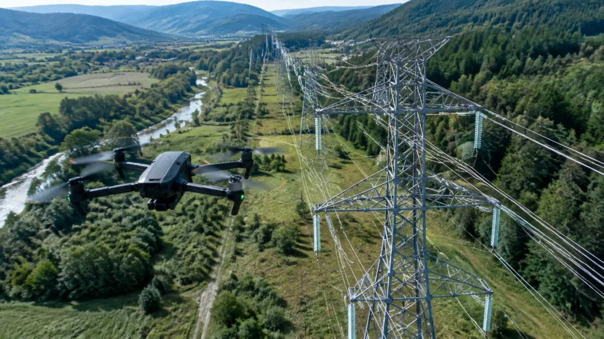
A roof, bridge or powerline can be difficult, and sometimes dangerous, to inspect closely. Drone inspection services can provide a clear view without putting a worker on a ladder, under a bridge or near energized infrastructure. The result is useful documentation that helps clients plan next steps.
We asked Rob Miller, studio videographer, cinematographer and licensed drone pilot at Spokane Productions, how he approaches inspections, construction documentation and hard-to-reach sites.
ACCESSING HARD-TO-REACH ASSETS
Getting the right view can mean ladders, scaffolding, rope access, lifts or specialized vehicles. Each adds time, cost and risk. I asked Rob where aerial inspection makes a practical difference, and where a drone is not a substitute for a qualified inspector.
Penny Asked: What can a drone inspect more safely or affordably than traditional access methods?
Rob: A drone can help document roofs, building facades, towers, bridges and other hard-to-reach areas. Instead of putting someone on a roof or arranging access equipment just to get a visual overview, we can often capture the condition from the air. That can reduce exposure to falls and help the client decide where a closer, hands-on inspection is needed.
It’s important to be clear about what the footage can do. A drone gives you visual evidence; it doesn’t certify structural integrity or replace an engineer’s assessment. We plan the capture around the client’s inspection goals and the site’s safety requirements.
The aircraft matters, too. Our Mavic 2 Pro is a general-purpose option for inspections, construction documentation, engineering and photogrammetry or mapping. The Inspire 2 is for cinematic work. Its dual-operator mode lets one person concentrate on flying while another operates the camera, supporting safer, more fluid video capture.

DRONE INSPECTION SERVICES FOR CONSTRUCTION AND INFRASTRUCTURE
A repeatable aerial view can give project teams a shared record of site conditions. I asked Rob how he makes that documentation useful beyond a single day’s footage.
Penny Asked: How can drone documentation help a construction or engineering project over time?
Rob: We can capture regular site overviews, so a project team can see what changed between visits and share updates with stakeholders. When the job calls for it, photogrammetry and mapping can help create orthomosaics or 3D models. The right deliverable depends on the project and the level of measurement or detail required.
A dated visual record can also help clarify what was visible at a particular point in time. I’ve been hired for construction and engineering documentation, roofing work, radon remediation, property-damage documentation, landlord evictions and a boundary dispute. Those are different assignments, but they share a need for clear, organized evidence.
For mapping where measured accuracy matters, the capture and processing need to be scoped properly. Survey-grade results may require an RTK-capable workflow and ground control points. A standard aerial photo should not be presented as a survey.

Powerlines, pipelines and bridges bring another consideration: access can be costly and hazardous. Industry examples show that drones may reduce inspection costs by 40–70% when they replace access equipment, closures or extensive manual work. That range is a planning reference, not a guaranteed saving on every job. For selected pipeline and utility workflows, published reports describe inspection timelines falling from days to hours. One cited solar-inspection comparison reported roughly 99% agreement with manual results. A result specific to that study, not a universal accuracy claim for drone inspections. Infrastructure inspection cost examples and a published drone inspection case study offer further context.
The broader construction drone market is also growing. One commercial forecast estimates a $9.05 billion market in 2026, with approximately 14% annual growth. Forecasts vary by source and market definition, but the trend reflects growing use of drones for site documentation, surveying and inspection. The Business Research Company’s construction drone market estimate is one such projection.
COMPLIANCE, LIABILITY AND FLIGHT PLANNING
A professional capture starts before takeoff. I asked Rob what facility managers and contractors should verify when they hire a drone pilot.
Penny Asked: What should a client check before commissioning commercial drone work?
Rob: Start by confirming the pilot is qualified for the job and understands the site’s airspace. Commercial operations generally require an FAA Part 107 remote pilot certificate. The pilot needs to maintain currency through recurrent training every 24 calendar months. The aircraft must be registered as required and comply with Remote ID rules. Some flights also require operational approval for controlled airspace.
The FAA says failure to register an aircraft that must be registered can result in civil penalties of up to $27,500. That figure is specific to registration enforcement; it is not an automatic fine for every flight. FAA registration guidance and Part 107 airspace authorization requirements explain key requirements.
There can also be financial and legal consequences if an unlicensed or uninsured pilot causes an incident. A commissioning party may face liability depending on the circumstances, and recreational operators often do not carry commercial insurance. Ask about the pilot’s certificate, aircraft registration, Remote ID compliance, required airspace approvals and insurance before booking.
We use a four-step process: scouting, safety and compliance, capturing, and delivery. We review the site, hazards, weather and airspace before the flight. In Rob’s experience, many airspace approvals come through within minutes, while some urban locations may require planning 30–60 days ahead. Timing depends on the location and approval required, so early coordination matters.
WHAT THE CLIENT RECEIVES
Inspection work is only useful if the files are clear, organized and ready for the next decision. I asked Rob what clients can expect after the flight.
Penny Asked: What do you deliver, and how do you protect the footage?
Rob: It depends on the brief. A client may need high-resolution stills, 4K video, or a sequence of views showing specific areas. If mapping is part of the scope, we can discuss orthomosaics or 3D models and what the project needs for accurate measurements.
We agree on the deliverables before the flight, then organize the media for handoff. For projects we’re editing, footage is backed up in three locations while post-production is underway. That gives the client and production team a dependable record to work from.
If you’re planning an inspection, what needs to be documented, and who needs to use the results? Share the site, timing and intended deliverables with us. We’ll help you work out a practical plan.
PLAN YOUR NEXT INSPECTION WITH SPOKANE PRODUCTIONS
Spokane Productions can support a focused aerial documentation job or help connect the capture to a larger production. Learn more about our drone and video production services or read Rob Miller’s interview about professional drone work.
Contact Spokane Productions to discuss your inspection. Our studio is at 5380 E Seltice Way, Suite A, Post Falls, Idaho. We look forward to working with you!
